
contour
A contour is a line on a map joining places of equal elevation. Closely spaced contours indicated a steep slope, few or no contours mean flat or almost flat ground.
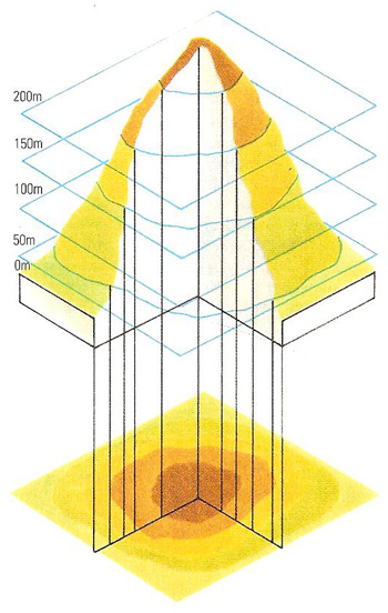
Reproducing a three-dimensional shape on a flat surface is a problem that can be solved by the convention of contour scaling. This is in the accompanying diagram shown when the cross-sections of a hill at 50-, 100-, 150-, and 200-meter heights are projected onto a map of the hill. The hill can be envisaged fairly well from such a map, although the "coarseness" of the contour intervals loses some finer detail. The steepness of the sides can be judged by the contour lines on the map.

