
GFO (Geosat Follow-On)
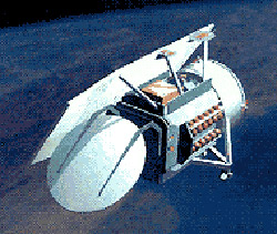
GFO (Geosat Follow-On) is a successor to the Geosat program which flew between 1985 and 1990. GFO provides real-time ocean topography data to 65 United States Navy users at sea and on shore. This data on wave heights, currents, and fronts is also archived and made available to scientific and commercial users through NOAA (National Oceanic and Atmospheric Administration). A 13.5-GHz radar altimeter is the primary payload, providing wave-height measurements to an accuracy of 3.5 centimeters.
| launch date | Feb 10, 1998 |
| launch vehicle | Taurus |
| launch site | Vandenberg AFB |
| orbit | 785 × 788 km × 8.1° |
| mass | 47 kg |
| max. length | 3 m |

