
RADARSAT
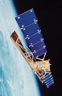
RADARSAT is a Canadian satellite equipped with a powerful synthetic aperture radar (SAR) – the world's first civilian satellite SAR – that is an important source of environmental and resource information. RADARSAT's steerable, 15-meter-wide SAR dish collects images of the ocean and land, with a resolution of 8–100 meters, irrespective of weather conditions and the time of day. Its data is used by shipping companies in North America, Europe and Asia and by government agencies that carry out ice reconnaissance and mapping, and is also a valuable tool for mapping Earth's structural features such as faults, folds, and lineaments. These features provide clues to the distribution of ground water, mineral deposits, and oil and gas in the planet's crust. RADARSAT can facilitate the mapping and planning of land use and monitor disasters such as oil spills, floods and earthquakes. It also provides the first routine surveillance of the entire Arctic – covering the Arctic daily and most of Canada every three days from a sun-synchronous orbit.
| launch date | Nov 4, 1995 |
| launch vehicle | Delta 7925 |
| launch site | Vandenberg Air Force Base |
| orbit | 790 × 792 km × 99° |
| mass | 2,713 kg |

