
weather satellites
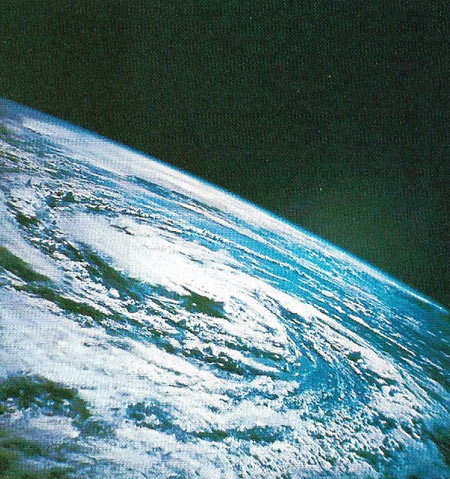
Hurricane Gladys, as seen by the Apollo 7 astronauts in October 1968. Meteorological satellites now routinely photograph Earth's cloud cover, ro aid weather forecasting. They have saved many lives by predicting the likely courses of hurricanes.
A weather satellite, also called a meteorological satellite, is a spacecraft used to monitor Earth's atmospheric conditions and provide data to help understand and predict global weather patterns. The first was TIROS-1 in 1960. Over the past several decades, the United States, Russia, Europe, and other nations have launched weather satellites into both both polar orbits and geostationary orbits. Photographic histories of hurricane development and the discovery of large-scale coherence in cloud and other weather patterns have greatly helped weather forecasting.
For more details on specific programs and series of spacecraft see:

